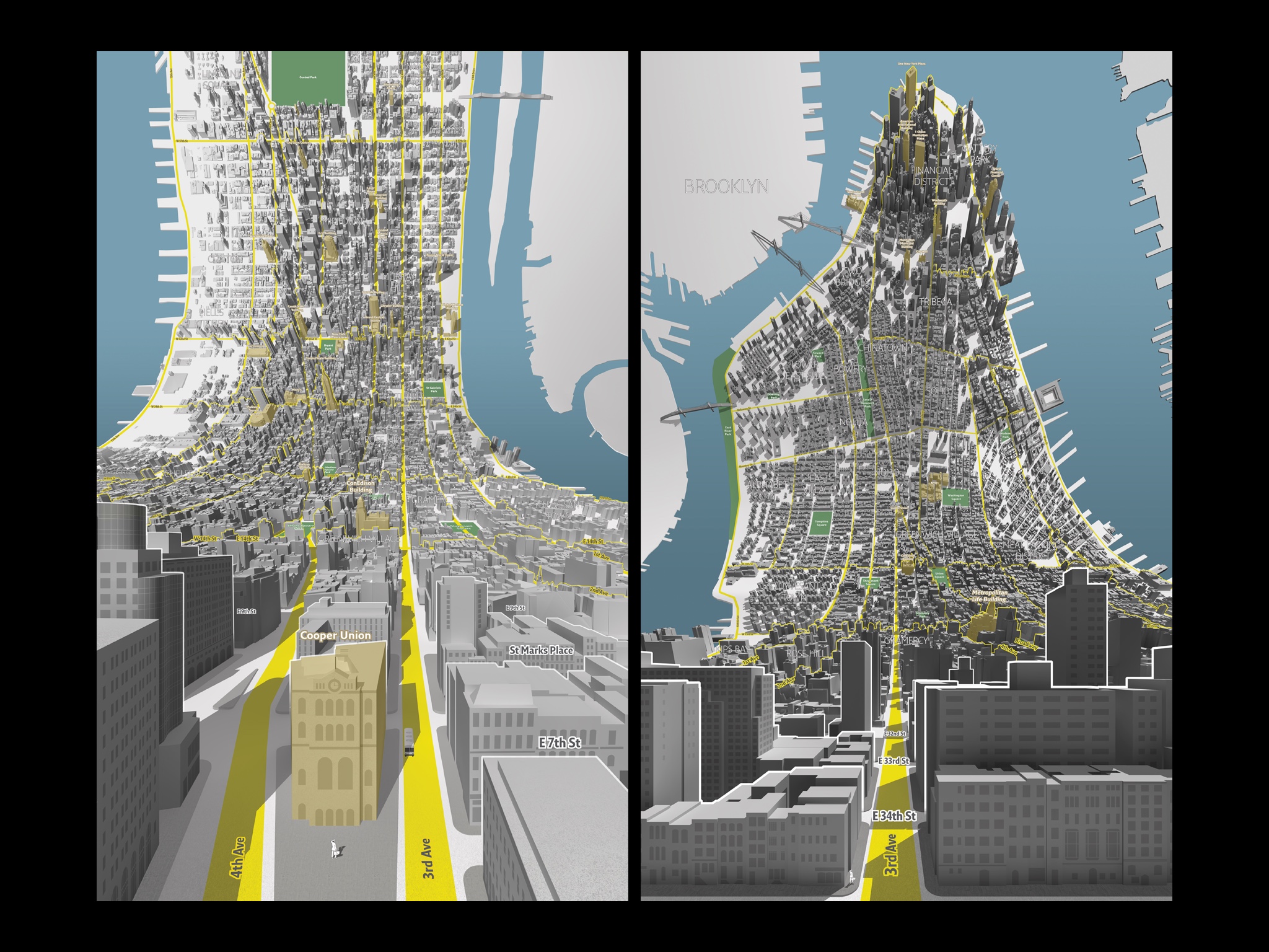
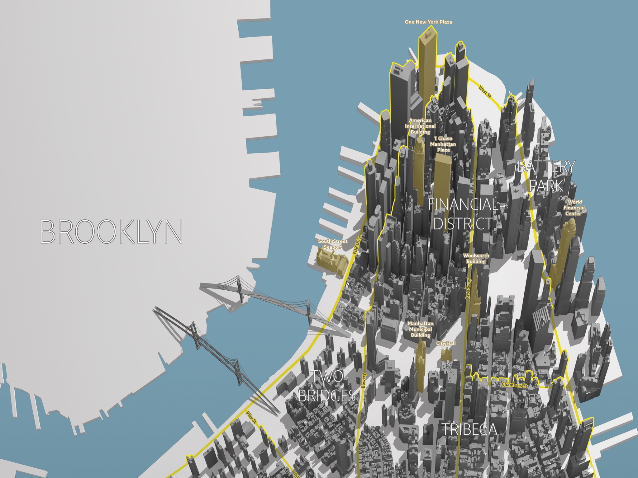
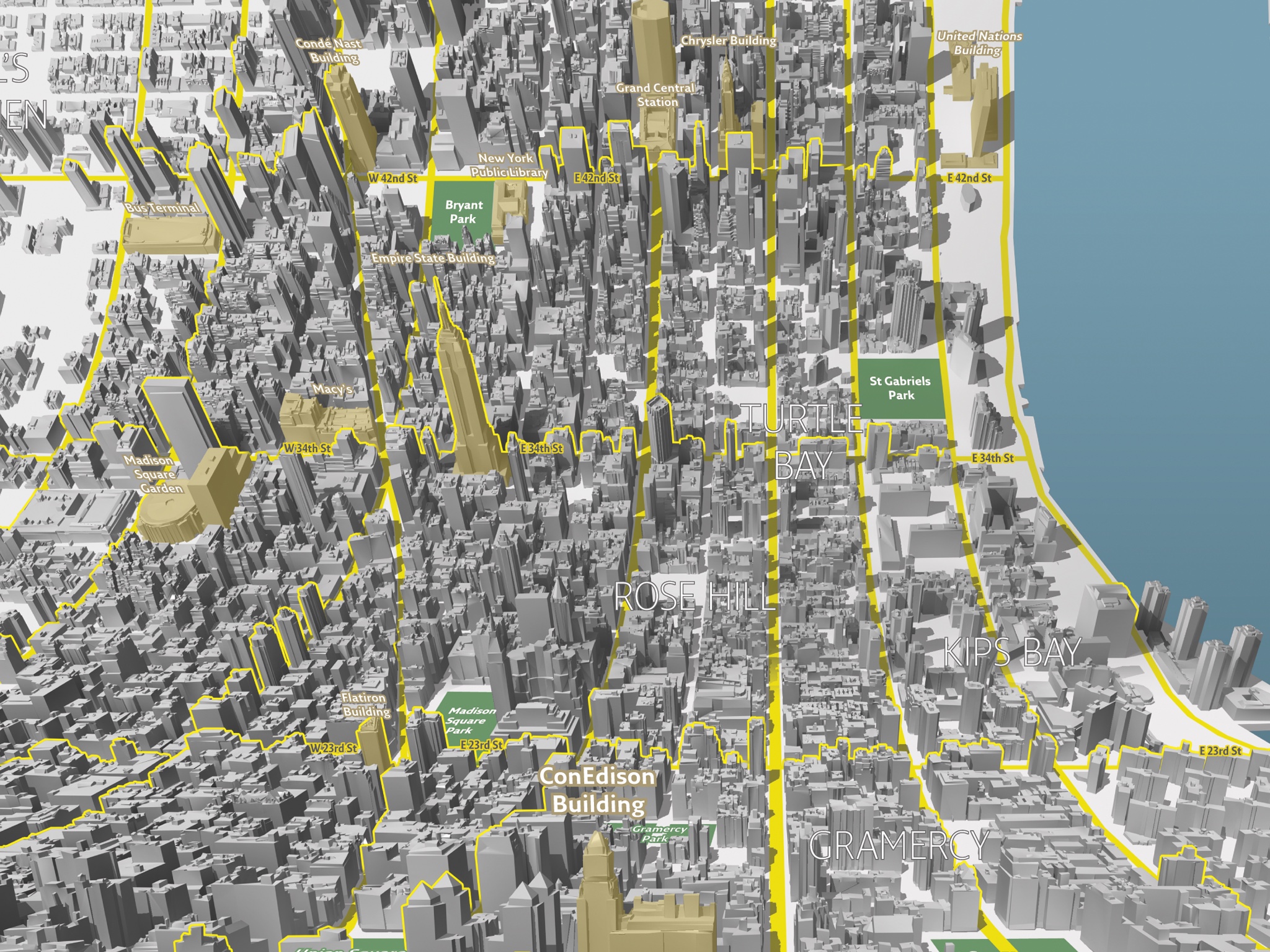
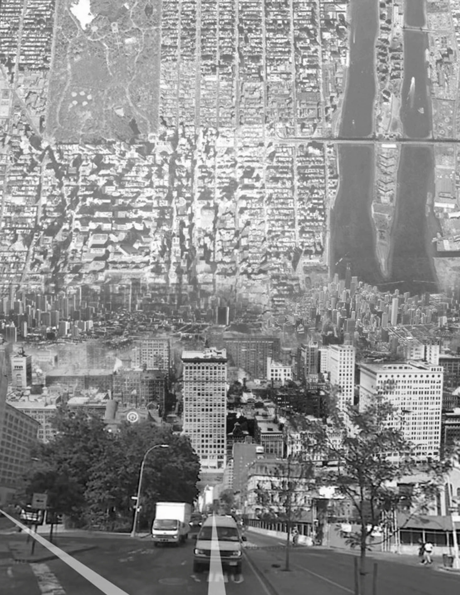
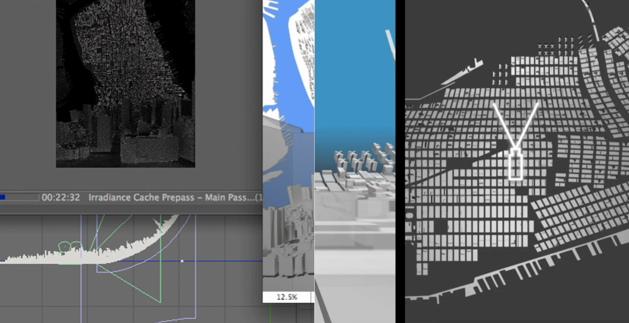
The maps begin in three dimensions at the viewer's feet, then curl upward into a more traditional top-down projection — the effect of being simultaneously inside and above a city. It is a map for navigating a place you are already standing in, while seeing where you are headed.
The name comes from the quality of the projection itself: the here of street level and the there of the aerial view folded into a single image. The horizon is removed entirely — the city just keeps going, curving up and over.
Each map is tied to a specific corner: one looks uptown from 3rd and 7th, the other downtown from 3rd and 35th, and both were made to be read while standing at those intersections. Landmarks are picked out in gold. A single figure stands outside Cooper Union on one map, and appears again far in the distance on the other.
Here & There was featured in Wired UK and exhibited at MoMA, New York as part of Talk to Me: Design and the Communication Between People and Objects (2011). It is now in MoMA's permanent collection.
The projection was also modelled in motion, as a form of in-car navigation: there is a short post on the idea and a video of the drive.
- Design
- Jack Schulze, James King
- Technical Direction, Design & 3D
- Campbell Orme
- Studio
- BERG, London
- Exhibition
- Talk to Me, Museum of Modern Art, New York, 2011
- Collection
- Museum of Modern Art, New York · permanent collection
- Prints
- Limited edition of numbered offset litho prints, 3ft × 2ft